PLAN - ASCEND - CONTROL

NDAA-compliant and American-made

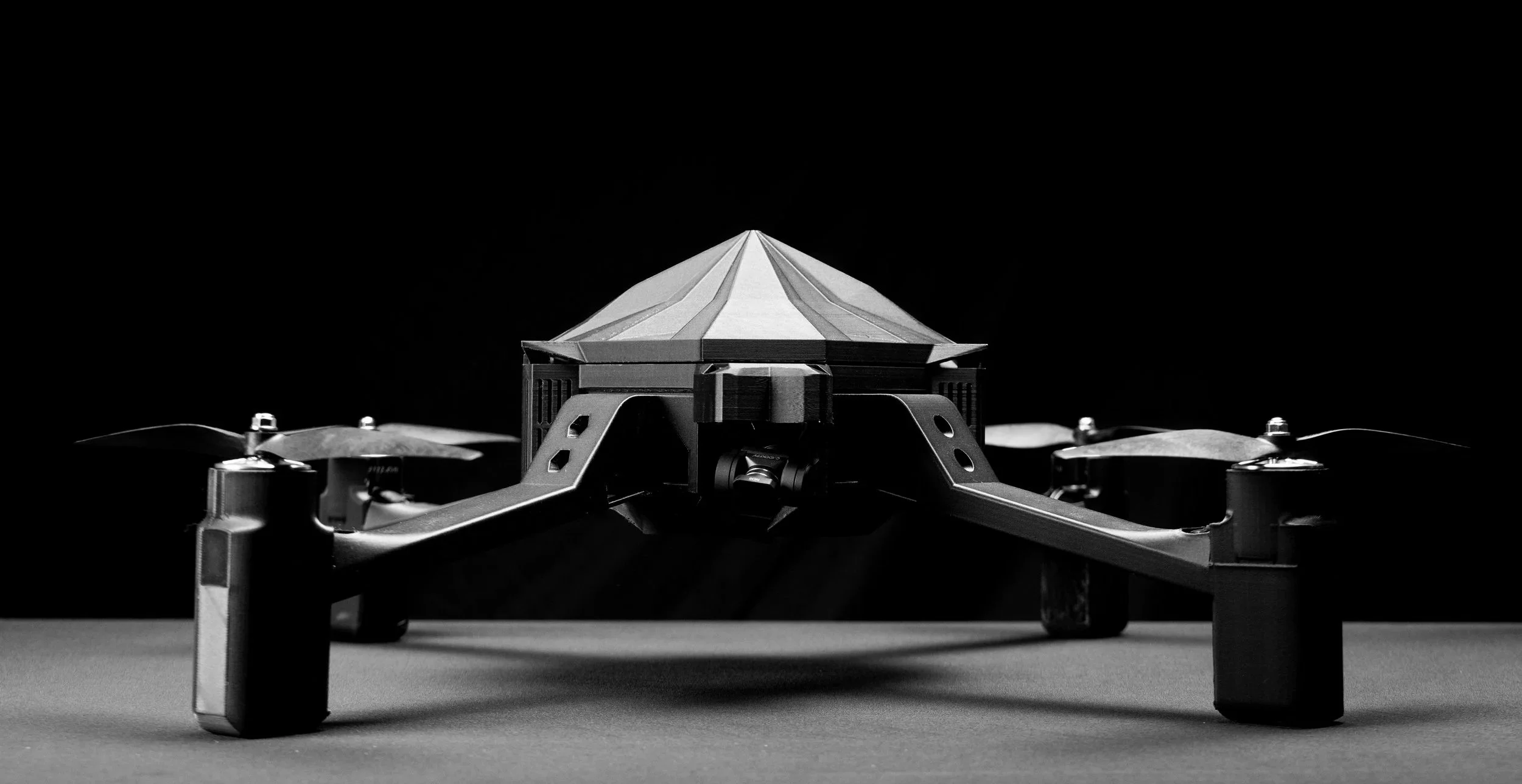
3D Printed Design for Front Line Repairs Keeping you on the battlefield.

up to 60 minute flight time
up to 60 MPH speed
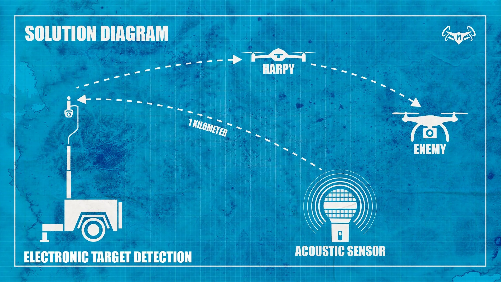
HARPY: Modular. Rugged. Mission-Driven.
Harpy is a purpose-built counter-UAS platform designed to neutralize aerial threats with precision and resilience. Built for kinetic engagement, Harpy can physically impact hostile drones at speeds up to 60 MPH without sustaining damage. Its 3D-printed modular frame allows for rapid field repair and part replacement—keeping operators in the fight. With a 60-minute flight time and American-made, NDAA-compliant components, Harpy is a battlefield asset ready on day one. Built Different—Because It Had to Be. The Harpy is a low-cost, high-performance counter-UAS solution born from necessity. Its reloadable Talon system—our answer to the centerfire cartridge—can snare, strike, or recover targets with a battlefield- ready quick-release. NDAA-compliant and American-made, Harpy isn’t just a drone—it’s a mission-driven evolution in aerial dominance. Odin’s Trials proved it. The warfighter demanded it. Mockingbird delivers it.
CONTACT
info@mockingbirddefense.com

ELEVATE YOUR COMMAND

NEXUS FLIGHT
encompasses a whole ecosystem to detect enemy personnel and UAV’s giving you the ultimate battlefield advantage. And it all Integrates with ATAK.
-
• Combat-proven in Ukraine; identifies Russian, Ukrainian, and Chinese drones.
• Creates a 300-meter detection bubble.
• Lightweight — wearable, field-deployable, or drone-dropped.
• Multiple units link into a “picket fence” wall of coverage.
• Gives units early drone warning without giving away position
-
• Immersive 3D training and mission planning tool.
• Built on Google Earth, Unreal Engine, and satellite imagery.
• Render any location on Earth using GPS coordinates or an address.
• Lets units rehearse in the exact terrain before operations.
• Saves time, money, and equipment by reducing training crashes.